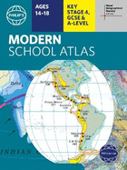
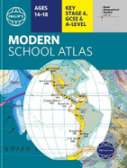
- Britain's best-selling school atlas - now in its 100th edition - Recommended for Key Stage 4, GCSE and A-level in England and Wales (Scottish National Qualifications/Highers) and international schools. - Fully updated to reflect the latest changes in the curriculum - Published in association with the Royal Geographical Society - Combines superb digital maps of Britain and the world with up-to-date thematic maps across a wide range of topics - Essential learning including political, physical, climate and thematic mapping - ...
Read More
- Britain's best-selling school atlas - now in its 100th edition - Recommended for Key Stage 4, GCSE and A-level in England and Wales (Scottish National Qualifications/Highers) and international schools. - Fully updated to reflect the latest changes in the curriculum - Published in association with the Royal Geographical Society - Combines superb digital maps of Britain and the world with up-to-date thematic maps across a wide range of topics - Essential learning including political, physical, climate and thematic mapping - Country-by-country statistics on population, land use, trade, tourism, energy, wealth and much more - World Themes Section - from volcanoes to population trends all the key aspects of geography are explored - Plus a special section on how satellite imagery is used to interpret global, environmental and urban patterns of change The contents are divided into sections for ease of use, with each page colour-coded for rapid reference. It contains clear explanations of scale, latitude and longitude, map projections and Geographical Information Systems (GIS). The physical maps of the United Kingdom and Ireland are accompanied by thematic maps on numerous key social and economic themes. The middle section is made up of World topographical maps, incorporating continental thematic maps on topics such as climate, population and economics, followed by 30 pages of World thematic maps. Completing the atlas is a section of World social and economic statistics, accompanied by the index to the topographical maps in the atlas, showing letter-figure grid references as well as latitude and longitude co-ordinates. Available in both hardback and paperback formats, Philip's Modern School Atlas 100th Edition is an unbeatable combination of highly detailed physical mapping backed up by numerous tables and enlightening thematic maps.
Read Less
Add this copy of Philip's RGS Modern School Atlas: 100th edition to cart. $14.76, like new condition, Sold by GreatBookPrices rated 4.0 out of 5 stars, ships from Columbia, MD, UNITED STATES, published 2021 by Philip's.
Choose your shipping method in Checkout. Costs may vary based on destination.
Seller's Description:
Fine. Philip's World Atlas . Intended for a juvenile audience. In Stock. 100% Money Back Guarantee. Brand New, Perfect Condition, allow 4-14 business days for standard shipping. To Alaska, Hawaii, U.S. protectorate, P.O. box, and APO/FPO addresses allow 4-28 business days for Standard shipping. No expedited shipping. All orders placed with expedited shipping will be cancelled. Over 3, 000, 000 happy customers.
Add this copy of Philip's Rgs Modern School Atlas to cart. $17.23, new condition, Sold by Paperbackshop rated 4.0 out of 5 stars, ships from Bensenville, IL, UNITED STATES, published 2021 by Octopus Publishing Group.
Add this copy of Philip's RGS Modern School Atlas: 100th edition to cart. $22.55, new condition, Sold by Booksplease rated 4.0 out of 5 stars, ships from Southport, MERSEYSIDE, UNITED KINGDOM, published 2021 by Philip's.
Add this copy of Philip's Rgs Modern School Atlas: 100th Edition (Philip to cart. $22.82, new condition, Sold by Revaluation Books rated 4.0 out of 5 stars, ships from Exeter, DEVON, UNITED KINGDOM, published 2021 by Philip's.
Add this copy of Philip´S Rgs Modern School Atlas: 100th Edition to cart. $34.60, new condition, Sold by Kennys.ie rated 4.0 out of 5 stars, ships from Galway, IRELAND, published 2021 by Philip's.