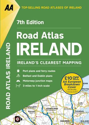
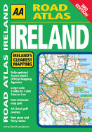
Updated from Ireland's Official Mapping Agencies, OSI and OSNI, the "AA Road Atlas Ireland" includes AA approved camping sites and AA recommended golf courses, car parks, picnic sites, port plans and ferry routes plus motorway strip maps including the M1 Toll Drogheda bypass. There are 11 detailed city and town plans: Belfast, Cork, Londonderry, Dublin, Dun, Laoghaire, Galway, Killkarney, Limerick, Sligo and Waterford; and an easy-to-read 3,500 place name index which including tourist sites.
Read More
Updated from Ireland's Official Mapping Agencies, OSI and OSNI, the "AA Road Atlas Ireland" includes AA approved camping sites and AA recommended golf courses, car parks, picnic sites, port plans and ferry routes plus motorway strip maps including the M1 Toll Drogheda bypass. There are 11 detailed city and town plans: Belfast, Cork, Londonderry, Dublin, Dun, Laoghaire, Galway, Killkarney, Limerick, Sligo and Waterford; and an easy-to-read 3,500 place name index which including tourist sites.
Read Less
Add this copy of Road Atlas Ireland to cart. $44.05, good condition, Sold by Bonita rated 4.0 out of 5 stars, ships from Newport Coast, CA, UNITED STATES, published 2017 by AA Publishing.