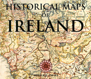
The first recorded maps of Ireland were drawn in the 16th Century. By law, (a law that is in effect to this day, ) the British government had to have an accurate representation of layout and terrain of all of their possessions. These maps provide a fascinating and colorful insight into the changing landscape as towns grew and harbors were created. It is a tribute to the accuracy, detail and art of the cartographers of the time.
Read More
The first recorded maps of Ireland were drawn in the 16th Century. By law, (a law that is in effect to this day, ) the British government had to have an accurate representation of layout and terrain of all of their possessions. These maps provide a fascinating and colorful insight into the changing landscape as towns grew and harbors were created. It is a tribute to the accuracy, detail and art of the cartographers of the time.
Read Less
Add this copy of Historical Maps of Ireland to cart. $12.00, very good condition, Sold by Eat My Words rated 4.0 out of 5 stars, ships from Minneapolis, MN, UNITED STATES, published 1999 by Book Sales.
Choose your shipping method in Checkout. Costs may vary based on destination.
Seller's Description:
Very Good+ in Very Good dust jacket. 0785811095. Binding solid. Pages unmarked and bright. Decorated cover has minor wear to corners, but otherwise glossy and fine. Dustjacket has a little wear to edges.; 11.2 X 9.6 X 0.7 inches; 144 pages.
Add this copy of Historical Maps of Ireland to cart. $20.00, very good condition, Sold by Common Crow Books rated 5.0 out of 5 stars, ships from Pittsburgh, PA, UNITED STATES, published 1999 by Book Sales.
Choose your shipping method in Checkout. Costs may vary based on destination.
Seller's Description:
Very Good + in good + jacket. Oblong 4to, pictorial hardcover in dust jacket. Illustrated throughout in color and b&w. Mildest shelfwear to tips, with contents clean. Dust jacket has short closed tears to extremities.
Add this copy of Historical Maps of Ireland to cart. $21.19, like new condition, Sold by J. Patrick McGahern Books, Inc rated 3.0 out of 5 stars, ships from Ottawa, ON, CANADA, published by London. Chartwell Books, Inc. 1999.
Choose your shipping method in Checkout. Costs may vary based on destination.
Seller's Description:
Dust Jacket Included. Oblong4to, 24.5x 27cm, 144p., with over 120 mainly colour plates and illustrations, map title index, colour illustrated coated boards, a fine copy in fine jacket, as new (gar). ~ A history of Ireland through cartography with maps and charts reprinted from the originals held by the Public Records Office in Kew, London.
Add this copy of Historical Maps of Ireland to cart. $23.19, good condition, Sold by Helping Hands Global rated 3.0 out of 5 stars, ships from Kansas city, MO, UNITED STATES, published 1999 by Book Sales.
Add this copy of Historical Maps of Ireland to cart. $25.95, like new condition, Sold by Wm Burgett Bks & Collectibles rated 4.0 out of 5 stars, ships from San Diego, CA, UNITED STATES, published 1999 by Book Sales.
Choose your shipping method in Checkout. Costs may vary based on destination.
Seller's Description:
Fine. No Jacket. Fine clean hardcover with no dust jacket. Has prior owner's name on front free end page. Large or heavy book and may require extra postage. No AMAZON international order on this title. Size: 4to-over 9¾"-12" tall.
Add this copy of Historical Maps of Ireland to cart. $27.50, like new condition, Sold by Wm Burgett Bks & Collectibles rated 4.0 out of 5 stars, ships from San Diego, CA, UNITED STATES, published 1999 by Book Sales.
Choose your shipping method in Checkout. Costs may vary based on destination.
Seller's Description:
Fine. No Jacket. Fine clean hardcover with no dust jacket. Large or heavy book and may require extra postage. No AMAZON international order on this title. Size: 4to-over 9¾"-12" tall.
Add this copy of Historical Maps of Ireland to cart. $42.47, good condition, Sold by Bonita rated 4.0 out of 5 stars, ships from Newport Coast, CA, UNITED STATES, published 1999 by Book Sales.
Add this copy of Historical Maps of Ireland to cart. $79.98, new condition, Sold by GridFreed rated 4.0 out of 5 stars, ships from North Las Vegas, NV, UNITED STATES, published 1999 by Book Sales.
Add this copy of Historical Maps of Ireland to cart. $93.73, new condition, Sold by Bonita rated 4.0 out of 5 stars, ships from Newport Coast, CA, UNITED STATES, published 1999 by Book Sales.
Add this copy of Historical Maps of Ireland to cart. $2,470.00, new condition, Sold by BWS Bks rated 5.0 out of 5 stars, ships from Ferndale, NY, UNITED STATES, published 1999 by Book Sales.
Choose your shipping method in Checkout. Costs may vary based on destination.
Seller's Description:
New. 0785811095. *** FREE UPGRADE to Courier/Priority Shipping Upon Request ***-*** IN STOCK AND IMMEDIATELY AVAILABLE FOR SHIPMENT-Flawless copy, brand new, pristine, never opened--144 pages; well illustrated. --with a bonus offer--