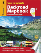
This backroad mapbook is a complete road and recreation atlas for the central area of Alberta, an area of the province with extensive wilderness for outdoor recreation. It covers the central area of Alberta, from the Rocky Mountain foothills to the Alberta/Saskatchewan border and from Olds and Red Deer in the south to Whitecourt and Lac la Biche in the north. Edmonton is located in the centre of the area covered. It includes 62 colour recreational GPS-compatible topographical relief maps and detailed maps of Edmonton, Red ...
Read More
This backroad mapbook is a complete road and recreation atlas for the central area of Alberta, an area of the province with extensive wilderness for outdoor recreation. It covers the central area of Alberta, from the Rocky Mountain foothills to the Alberta/Saskatchewan border and from Olds and Red Deer in the south to Whitecourt and Lac la Biche in the north. Edmonton is located in the centre of the area covered. It includes 62 colour recreational GPS-compatible topographical relief maps and detailed maps of Edmonton, Red Deer, Rocky Mountain House, Whitecourt, Lac la Biche, and Lloydminster. The maps include backroads, logging roads, trails, parks, and the locations of campsites and outdoor recreational opportunities. The book provides information on hiking and biking trails, horseback riding and ATVing trails, lake and stream fishing, paddling, parks, recreational areas, wildlife viewing areas, and skiing, snowshoeing, and snowmobiling opportunities.
Read Less
Add this copy of Central Alberta Backroad M to cart. $81.59, good condition, Sold by Bonita rated 4.0 out of 5 stars, ships from Newport Coast, CA, UNITED STATES, published 2006 by Backroad Mapbooks.