Trekking the Hadrian's Wall Path (2024 Updated Version): National Trail Guidebook with OS 1:25k maps: Two-way: described east-west and west-east (The Great Treks of England)
Trekking the Hadrian's Wall Path (2024 Updated Version): National Trail Guidebook with OS 1:25k maps: Two-way: described east-west and west-east (The Great Treks of England)
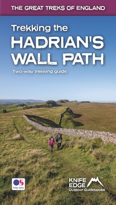
Hadrian's Wall was one of the Romans' most ambitious structures. When completed, it ran for 73 miles between the west and east coasts of Northern England. It crossed the crags and hills of some of Britain's wildest and most beautiful terrain. The Hadrian's Wall path is one of England's official 'National Trails'. It leads you on an unforgettable journey of discovery along the route of the Wall. Discover the incredible surviving sections of the Wall and its forts, milecastles and turrets. This definitive two-way guide to ...
Read More
Hadrian's Wall was one of the Romans' most ambitious structures. When completed, it ran for 73 miles between the west and east coasts of Northern England. It crossed the crags and hills of some of Britain's wildest and most beautiful terrain. The Hadrian's Wall path is one of England's official 'National Trails'. It leads you on an unforgettable journey of discovery along the route of the Wall. Discover the incredible surviving sections of the Wall and its forts, milecastles and turrets. This definitive two-way guide to the Hadrian's Wall Path contains real OS mapping at 1:25,000 and both eastbound and westbound routes are described in full. There are 14 different itineraries with schedules of 3, 4, 5, 6, 7, 8 and 9 days for walkers and runners and the guide includes both eastbound and westbound itineraries. Difficult calculations of time, distance and altitude gain are done for you. Also includes: * Extraordinary detail on the history and construction of Hadrian's Wall * Section on the unmissable forts of Hadrian's Wall * Detailed information on equipment and travelling light * Everything the trekker needs to know: route, costs, difficulty, weather, travel, and more * Full accommodation listings: the best inns, B&Bs and hotels * Information for both self-guided and guided trekkers * Numbered waypoints linking the Real Maps to our clear descriptions
Read Less
Add this copy of Trekking the Hadrian's Wall Path (2024 Updated Version) to cart. $19.77, new condition, Sold by GreatBookPrices rated 4.0 out of 5 stars, ships from Columbia, MD, UNITED STATES, published 2021 by Knife Edge Outdoor Limited.
Choose your shipping method in Checkout. Costs may vary based on destination.
Seller's Description:
New. Contains: Unspecified. Great Treks of England . Includes unspecified. In Stock. 100% Money Back Guarantee. Brand New, Perfect Condition, allow 4-14 business days for standard shipping. To Alaska, Hawaii, U.S. protectorate, P.O. box, and APO/FPO addresses allow 4-28 business days for Standard shipping. No expedited shipping. All orders placed with expedited shipping will be cancelled. Over 3, 000, 000 happy customers.
Add this copy of Trekking the Hadrian's Wall Path (2024 Updated Version) to cart. $19.78, new condition, Sold by Ingram Customer Returns Center rated 5.0 out of 5 stars, ships from NV, USA, published 2021 by Knife Edge Outdoor Limited.
Add this copy of Trekking the Hadrian's Wall Path National Trail to cart. $20.48, new condition, Sold by Paperbackshop rated 4.0 out of 5 stars, ships from Bensenville, IL, UNITED STATES, published 2021 by Knife Edge Outdoor Limited.
Add this copy of Trekking the Hadrian's Wall Path: Two-Way Trekking to cart. $21.17, new condition, Sold by BargainBookStores rated 3.0 out of 5 stars, ships from Grand Rapids, MI, UNITED STATES, published 2021 by Knife Edge Outdoor.
Add this copy of Trekking the Hadrian's Wall Path (2024 Updated Version) to cart. $24.74, like new condition, Sold by GreatBookPrices rated 4.0 out of 5 stars, ships from Columbia, MD, UNITED STATES, published 2021 by Knife Edge Outdoor Limited.
Choose your shipping method in Checkout. Costs may vary based on destination.
Seller's Description:
Fine. Contains: Unspecified. Great Treks of England . Includes unspecified. In Stock. 100% Money Back Guarantee. Brand New, Perfect Condition, allow 4-14 business days for standard shipping. To Alaska, Hawaii, U.S. protectorate, P.O. box, and APO/FPO addresses allow 4-28 business days for Standard shipping. No expedited shipping. All orders placed with expedited shipping will be cancelled. Over 3, 000, 000 happy customers.
Add this copy of Trekking the Hadrian's Wall Path: Two-Way Trekking to cart. $24.75, very good condition, Sold by Ebooksweb rated 3.0 out of 5 stars, ships from Bensalem, PA, UNITED STATES, published 2021 by Knife Edge Outdoor Limited.