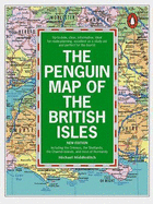
An up-to-date edition of this easy-to-read wall map which covers the whole of the British Isles and Normandy. Useful as a study aid and a general reference guide it can also be used as a route planner since all new motorways and motorway access points are marked.
Read More
An up-to-date edition of this easy-to-read wall map which covers the whole of the British Isles and Normandy. Useful as a study aid and a general reference guide it can also be used as a route planner since all new motorways and motorway access points are marked.
Read Less
Add this copy of The Penguin Map of the British Isles: Including the to cart. $65.69, good condition, Sold by Bonita rated 4.0 out of 5 stars, ships from Newport Coast, CA, UNITED STATES, published 1998 by Penguin UK.