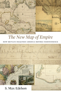
In 1763 British America stretched from Hudson Bay to the Keys, from the Atlantic to the Mississippi. Using maps that Britain created to control its new lands, Max Edelson pictures the contested geography of the British Atlantic world and offers new explanations of the causes and consequences of Britain's imperial ambitions before the Revolution.
Read More
In 1763 British America stretched from Hudson Bay to the Keys, from the Atlantic to the Mississippi. Using maps that Britain created to control its new lands, Max Edelson pictures the contested geography of the British Atlantic world and offers new explanations of the causes and consequences of Britain's imperial ambitions before the Revolution.
Read Less
Add this copy of The New Map of Empire: How Britain Imagined America to cart. $31.56, new condition, Sold by Ingram Customer Returns Center rated 5.0 out of 5 stars, ships from NV, USA, published 2017 by Harvard University Press.
Add this copy of The New Map of Empire: How Britain Imagined America to cart. $39.42, new condition, Sold by GreatBookPrices rated 4.0 out of 5 stars, ships from Columbia, MD, UNITED STATES, published 2017 by Harvard University Press.
Choose your shipping method in Checkout. Costs may vary based on destination.
Seller's Description:
New. Sewn binding. Cloth over boards. With dust jacket. 480 p. Contains: Maps. In Stock. 100% Money Back Guarantee. Brand New, Perfect Condition, allow 4-14 business days for standard shipping. To Alaska, Hawaii, U.S. protectorate, P.O. box, and APO/FPO addresses allow 4-28 business days for Standard shipping. No expedited shipping. All orders placed with expedited shipping will be cancelled. Over 3, 000, 000 happy customers.
Add this copy of The New Map of Empire: How Britain Imagined America to cart. $39.43, new condition, Sold by BargainBookStores rated 3.0 out of 5 stars, ships from Grand Rapids, MI, UNITED STATES, published 2017 by Harvard University Press.
Add this copy of The New Map of Empire How Britain Imagined America to cart. $42.40, new condition, Sold by Paperbackshop rated 4.0 out of 5 stars, ships from Bensenville, IL, UNITED STATES, published 2017 by Harvard University Press.
Add this copy of The New Map of Empire: How Britain Imagined America to cart. $47.10, new condition, Sold by Russell Books rated 4.0 out of 5 stars, ships from Victoria, BC, CANADA, published 2017 by Harvard University Press.