A brand new edition of this successful colour atlas of Leicestershire, giving the most comprehensive and detailed coverage of the county. No other atlas names every street in Leicestershire.The mapping is produced by the Ordnance Survey to our specification and gives the user complete coverage of all urban and rural areas. The mapping is at a standard scale of 3 1/2 inches to 1 mile, 2 1/2 inches to 1 mile in the pocket edition, and is complete with postcode boundaries.The atlas is ideally suited for both business and ...
Read More
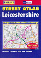
A brand new edition of this successful colour atlas of Leicestershire, giving the most comprehensive and detailed coverage of the county. No other atlas names every street in Leicestershire.The mapping is produced by the Ordnance Survey to our specification and gives the user complete coverage of all urban and rural areas. The mapping is at a standard scale of 3 1/2 inches to 1 mile, 2 1/2 inches to 1 mile in the pocket edition, and is complete with postcode boundaries.The atlas is ideally suited for both business and leisure use. There is a route-planning map and an administrative and postcode map at the front of the atlas. The main maps show every named road, street and lane clearly with through-routes highlighted. School locations are marked and emergency services, hospitals, police stations, car parks and rail and bus station locations are all featured. There is a comprehensive index of street names and postcodes that includes schools, industrial estates, hospitals, sports centres, etc, which are highlighted in colour.Main map scale: 2.5 inches to 1 mile
Read Less
Add this copy of Philip's Street Atlas Leicestershire (Philip's Street to cart. $17.95, good condition, Sold by Brit Books rated 4.0 out of 5 stars, ships from Milton Keynes, BUCKINGHAMSHIRE, UNITED KINGDOM, published 2003 by Philip's.
Choose your shipping method in Checkout. Costs may vary based on destination.
Seller's Description:
Good. Simply Brit welcome to our online used book store, where affordability meets great quality. Dive into a world of captivating reads without breaking the bank. We take pride in offering a wide selection of used books, from classics to hidden gems, ensuring there's something for every literary palate. All orders are shipped within 24 hours and our lightning fast-delivery within 48 hours coupled with our prompt customer service ensures a smooth journey from ordering to delivery. Discover the joy of reading with us, your trusted source for affordable books that do not compromise on quality.
Add this copy of Philip's Street Atlas Leicestershire to cart. $77.06, good condition, Sold by Bonita rated 4.0 out of 5 stars, ships from Newport Coast, CA, UNITED STATES, published 2003 by Philip's.