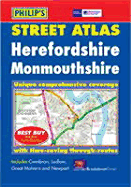
New and highly detailed colour atlas of Herefordshire & Monmouthshire that gives comprehensive coverage of the region. Every street in Herefordshire and Monmouthshire is shown.The mapping is based on Ordnance Survey data and gives the user complete coverage of all urban and rural areas. The urban mapping is at a standard scale of 31/2 inches to 1 mile (21/2 inches to 1 mile in the pocket edition) whilst the rural mapping retains the same detail at a reduced scale of 13/4 inches to 1 mile (11/4 inches to 1 mile in the pocket ...
Read More
New and highly detailed colour atlas of Herefordshire & Monmouthshire that gives comprehensive coverage of the region. Every street in Herefordshire and Monmouthshire is shown.The mapping is based on Ordnance Survey data and gives the user complete coverage of all urban and rural areas. The urban mapping is at a standard scale of 31/2 inches to 1 mile (21/2 inches to 1 mile in the pocket edition) whilst the rural mapping retains the same detail at a reduced scale of 13/4 inches to 1 mile (11/4 inches to 1 mile in the pocket edition). All mapping is complete with postcode boundaries.This atlas is ideally suited for both business and leisure use. The main maps show every named road, street and lane clearly with through-routes highlighted. There is also a useful route-planning map at the front of the atlas. School locations are marked and emergency services, hospitals, police stations, car parks and rail and bus station locations are all featured. There is a comprehensive index of street names and postcodes including schools, industrial estates, hospitals, sports centres, etc. and these are highlighted in red.Main map scale: 3.5 inches to 1 mile and 1.75 inches to 1 mile
Read Less