Using computer-generated map data from Ordnance Survey, this motoring atlas of Britain should be ideal for weekend drivers. A wealth of leisure information, including an eight-page directory of places to visit from the National Trust, English Heritage and Historic Scotland feature in this atlas. There are 95 pages of large-scale main road mapping which are fully compatible with OS walking maps. Based on the National Grid, they show masses of local detail, including places to visit, view points, camping and caravanning ...
Read More
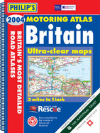
Using computer-generated map data from Ordnance Survey, this motoring atlas of Britain should be ideal for weekend drivers. A wealth of leisure information, including an eight-page directory of places to visit from the National Trust, English Heritage and Historic Scotland feature in this atlas. There are 95 pages of large-scale main road mapping which are fully compatible with OS walking maps. Based on the National Grid, they show masses of local detail, including places to visit, view points, camping and caravanning sights, Roman roads, ancient monuments and battlefields. Additional features include route-planning maps, an M25 map, eight large-scale city approach maps, a central London street plan, a distance table wit hestimated journey times, and 53 detailed town and city plans.
Read Less
Add this copy of Philip's Motoring Atlas Britain 2004 to cart. $22.37, good condition, Sold by Books From California rated 4.0 out of 5 stars, ships from Simi Valley, CA, UNITED STATES, published 2003 by Philip's.