Pennine Way - guide and maps to 57 towns and villages with large-scale walking maps (1:20 000): Edale to Kirk Yetholm - Planning, places to stay and places to eat
Pennine Way - guide and maps to 57 towns and villages with large-scale walking maps (1:20 000): Edale to Kirk Yetholm - Planning, places to stay and places to eat
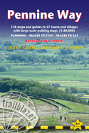
Trailblazer British Walking Guide to the Pennine Way, Britain's best-known National Trail that winds for 256 miles through three National Parks - the Peak District, Yorkshire Dales and Northumberland. This superb footpath showcases Britain's finest upland scenery, while touching the literary landscape of the Bronte family and Roman history along Hadrian's Wall. 138 large-scale walking maps - at just under 1:20,000 - showing route times, gradients, where to stay, interesting features. Guides to 57 towns and villages - along ...
Read More
Trailblazer British Walking Guide to the Pennine Way, Britain's best-known National Trail that winds for 256 miles through three National Parks - the Peak District, Yorkshire Dales and Northumberland. This superb footpath showcases Britain's finest upland scenery, while touching the literary landscape of the Bronte family and Roman history along Hadrian's Wall. 138 large-scale walking maps - at just under 1:20,000 - showing route times, gradients, where to stay, interesting features. Guides to 57 towns and villages - along the way. Itineraries for all walkers - whether walking the route in its entirety or sampling the highlights on day walks and short breaks. Practical information for all budgets - Edale to Kirk Yetholm. Where to stay with reviews - B&Bs, hostels, campsites, pubs and hotels. Where to eat with reviews. What to see, plus detailed town plans. Public transport information - for all access points on the path. GPS waypoints - also downloadable from the Trailblazer website. Extra colour sections: 16pp colour introduction and 16pp of colour mapping for stage sections (one stage per page) with trail profiles.
Read Less
Add this copy of Pennine Way - guide and maps to 57 towns and villages to cart. $14.32, new condition, Sold by GreatBookPrices rated 4.0 out of 5 stars, ships from Columbia, MD, UNITED STATES, published 2023 by Trailblazer Publications.
Choose your shipping method in Checkout. Costs may vary based on destination.
Seller's Description:
New. Sewn binding. Trailblazer Guides . In Stock. 100% Money Back Guarantee. Brand New, Perfect Condition, allow 4-14 business days for standard shipping. To Alaska, Hawaii, U.S. protectorate, P.O. box, and APO/FPO addresses allow 4-28 business days for Standard shipping. No expedited shipping. All orders placed with expedited shipping will be cancelled. Over 3, 000, 000 happy customers.
Add this copy of Pennine Way British Walking Guide Edal Format: to cart. $14.33, new condition, Sold by indoo rated 4.0 out of 5 stars, ships from Avenel, NJ, UNITED STATES, published 2023 by Trailblazer Publications.
Add this copy of Pennine Way-Guide and Maps to 57 Towns and Villages to cart. $16.84, new condition, Sold by Paperbackshop rated 4.0 out of 5 stars, ships from Bensenville, IL, UNITED STATES, published 2023 by Trailblazer Publications.
Add this copy of Pennine Way-Guide and Maps to 57 Towns and Villages to cart. $23.40, new condition, Sold by Ria Christie Books rated 5.0 out of 5 stars, ships from Uxbridge, MIDDLESEX, UNITED KINGDOM, published 2023 by Trailblazer Publications.
Add this copy of Pennine Way - guide and maps to 57 towns and villages to cart. $23.53, new condition, Sold by Ria Christie Books rated 5.0 out of 5 stars, ships from Uxbridge, MIDDLESEX, UNITED KINGDOM, published 2023 by Trailblazer Publications.