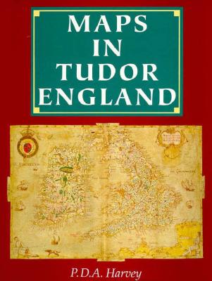
In this illustrated survey, drawing upon the extensive collections of maps preserved in the British Library, The Public Record Office and other archives, Professor Harvey discusses all the ways in which maps were used in Tudor England, and charts the progress of what he has termed a "cartographic revolution". Maps as we understand them today were effectively an invention of the 16th century, and the increase in both the use of and understanding of maps during that period was greatly aided by the spread of printing. ...
Read More
In this illustrated survey, drawing upon the extensive collections of maps preserved in the British Library, The Public Record Office and other archives, Professor Harvey discusses all the ways in which maps were used in Tudor England, and charts the progress of what he has termed a "cartographic revolution". Maps as we understand them today were effectively an invention of the 16th century, and the increase in both the use of and understanding of maps during that period was greatly aided by the spread of printing. Professor Harvey's study covers maps and their uses in all aspects of political life and ordinary daily life, with many illustrations.
Read Less
Add this copy of Maps in Tudor England to cart. $21.85, very good condition, Sold by HPB-Ruby rated 4.0 out of 5 stars, ships from Dallas, TX, UNITED STATES, published 1994 by University of Chicago Press.
Choose your shipping method in Checkout. Costs may vary based on destination.
Seller's Description:
Very good. Connecting readers with great books since 1972! Used books may not include companion materials, and may have some shelf wear or limited writing. We ship orders daily and Customer Service is our top priority!
Add this copy of Maps in Tudor England to cart. $21.95, very good condition, Sold by Book Trader Cafe rated 4.0 out of 5 stars, ships from NEW HAVEN, CT, UNITED STATES, published 1994 by University of Chicago Press.
Choose your shipping method in Checkout. Costs may vary based on destination.
Seller's Description:
Very Good. Size: 8x1x12; No Writing in text, slight wear to edges and cover. Ships with tracking the same or next business day from New Haven, CT. We fully guarantee to ship the exact same item as listed and work hard to maintain our excellent customer service.
Add this copy of Maps in Tudor England to cart. $24.95, very good condition, Sold by Adkins Books rated 5.0 out of 5 stars, ships from Chattanooga, TN, UNITED STATES, published 1994 by University of Chicago Press.
Add this copy of Maps in Tudor England to cart. $60.04, good condition, Sold by Bonita rated 4.0 out of 5 stars, ships from Newport Coast, CA, UNITED STATES, published 1994 by University of Chicago Press.
Add this copy of Maps in Tudor England to cart. $9.51, very good condition, Sold by ThriftBooks-Dallas rated 4.0 out of 5 stars, ships from Dallas, TX, UNITED STATES, published 1993 by Pub Rec.
Publisher:
The British Library Publishing Division
Published:
1993
Language:
English
Alibris ID:
14576102791
Shipping Options:
Standard Shipping: $4.99
Choose your shipping method in Checkout. Costs may vary based on destination.
Seller's Description:
Very good. A copy that has been read, but remains in excellent condition. Pages are intact and are not marred by notes or highlighting, but may contain a neat previous owner name. The spine remains undamaged. An ex-library book and may have standard library stamps and/or stickers. At ThriftBooks, our motto is: Read More, Spend Less.
Add this copy of Maps in Tudor England to cart. $12.71, very good condition, Sold by Magers and Quinn Booksellers rated 5.0 out of 5 stars, ships from Minneapolis, MN, UNITED STATES, published 1993 by The British Library Publishing Division.
Add this copy of Maps in Tudor England to cart. $16.09, good condition, Sold by Books From California rated 4.0 out of 5 stars, ships from Simi Valley, CA, UNITED STATES, published 1993 by The Publice Record Office / the.
Add this copy of Maps in Tudor England to cart. $18.00, very good condition, Sold by Adkins Books rated 5.0 out of 5 stars, ships from Chattanooga, TN, UNITED STATES, published 1993 by The British Library Publishing Division.
Add this copy of Maps in Tudor England to cart. $51.59, good condition, Sold by Bonita rated 4.0 out of 5 stars, ships from Newport Coast, CA, UNITED STATES, published 1993 by The Publice Record Office / th.
Add this copy of Maps in Tudor England to cart. $89.81, new condition, Sold by GridFreed rated 4.0 out of 5 stars, ships from North Las Vegas, NV, UNITED STATES, published 1993 by The Publice Record Office / the British Library.