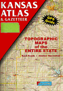
DeLorme continues to improve their atlases. Kansas includes GPS grids and uses shaded relief. Based upon 65 USGS quadrangles the scale is cut to 1:200,000. Contour interval is 120 feet. Annotation c. by Book News, Inc., Portland, Or.
Read More
DeLorme continues to improve their atlases. Kansas includes GPS grids and uses shaded relief. Based upon 65 USGS quadrangles the scale is cut to 1:200,000. Contour interval is 120 feet. Annotation c. by Book News, Inc., Portland, Or.
Read Less
Add this copy of Kansas Atlas & Gazetteer to cart. $19.97, very good condition, Sold by mark henderson rated 4.0 out of 5 stars, ships from Olathe, KS, UNITED STATES, published 1996 by Delorme.