Updated edition. Detailed topographic map 1:50.000 & 20 meter contours for hiking and trekking, printed as an atlas book (with overlapping pages). Covers the Nor Yauyos Cochas Landscape Reserve (RPNYC) located in the high and middle basin of the Ca???ete River, protecting one of the most beautiful landscapes of High Andes in Peru. Covers the tourist towns of Vitis, Huancaya, Vilca, Laraos, etc. inside the reserve as well as Quinches, Yauyos and others outside. 20 meter contour lines, road network, trails & paths, ...
Read More
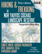
Updated edition. Detailed topographic map 1:50.000 & 20 meter contours for hiking and trekking, printed as an atlas book (with overlapping pages). Covers the Nor Yauyos Cochas Landscape Reserve (RPNYC) located in the high and middle basin of the Ca???ete River, protecting one of the most beautiful landscapes of High Andes in Peru. Covers the tourist towns of Vitis, Huancaya, Vilca, Laraos, etc. inside the reserve as well as Quinches, Yauyos and others outside. 20 meter contour lines, road network, trails & paths, transportation, food, campsites, shelters, guest houses & hotels.Mercator projection with both UTM and WGS84 coordinate grids. The map scale of 1:50000 (1 cm = 500 meters) provides a wealth of detail while keeping low the weight of the atlas itself. The large page format of 8.5x11in minimizes page count and along with an overlapping map design allows for comfortable navigation. The details included in the topographic maps of this atlas were specifically selected to be useful for trekkers, hikers and walkers of all interests, and make it easy to plan and enjoy both short excursions and hikes as well as long multi-day adventures along the main marked routes and/or adjacent trails and paths, which are also shown on the maps. With this ultralight atlas you will always have a detailed, reliable, information-rich, battery-independent, shatter-proof map for your adventure.
Read Less
Add this copy of Hiking & Trekking in Nor Yauyos Cochas Landscape to cart. $12.04, new condition, Sold by Ingram Customer Returns Center rated 5.0 out of 5 stars, ships from NV, USA, published 2018 by Createspace Independent Publishing Platform.
Add this copy of Hiking & Trekking in Nor Yauyos Cochas Landscape to cart. $24.86, new condition, Sold by Ria Christie Books rated 5.0 out of 5 stars, ships from Uxbridge, MIDDLESEX, UNITED KINGDOM, published 2018 by Createspace Independent Publishing Platform.
Add this copy of Hiking & Trekking in Nor Yauyos Cochas Landscape to cart. $36.69, good condition, Sold by Bonita rated 4.0 out of 5 stars, ships from Newport Coast, CA, UNITED STATES, published 2018 by CreateSpace Independent Publis.
Add this copy of Hiking & Trekking in Nor Yauyos Cochas Landscape to cart. $67.56, new condition, Sold by Bonita rated 4.0 out of 5 stars, ships from Newport Coast, CA, UNITED STATES, published 2018 by CreateSpace Independent Publis.