Add this copy of Hagstrom Westchester County Street Atlas & Metropolitan to cart. $31.27, good condition, Sold by BooksRun rated 4.0 out of 5 stars, ships from Philadelphia, PA, UNITED STATES, published 2001 by Hagstrom Map Co.
Add this copy of Hagstrom Westchester County Street Atlas & Metropolitan to cart. $65.00, good condition, Sold by CorgiPack rated 5.0 out of 5 stars, ships from Fulton, NY, UNITED STATES, published 2001 by Hagstrom Map Co.
Choose your shipping method in Checkout. Costs may vary based on destination.
Seller's Description:
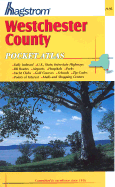
VG. Size: 12.8 x 10.3 x 0.5 inches; Very nice clean copy. Text free of highlighting and writing. Tightly bound. This detailed road atlas of Westchester County has a full street index in the back, and shows all highways, railroad and Path routes, tunnels, airports, hospitals, parks, golf courses and country clubs, cemeteries, and ZIP codes in the area. The Metropolitan New York section of the atlas shows highways and secondary roads, maps of major cities, scenic routes, maps of John F. Kennedy, La Guardia and Newark Airports, mileage charts, and points of interest around the city. 90 pages. Zip codes--New York (State)--Westchester County--Maps, Westchester County (N.Y. )--Maps.