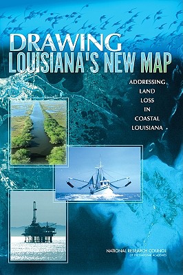
During the past 50 years, coastal Louisiana has suffered catastrophic land loss due to both natural and human causes. This loss has increased storm vulnerability and amplified risks to lives, property, and economies--a fact underscored by Hurricanes Katrina and Rita. Drawing Louisiana's New Map reviews a restoration plan proposed by the U.S. Army Corps of Engineers and the State of Louisiana, finding that, although the individual projects in the study are scientifically sound, there should be more and larger scale ...
Read More
During the past 50 years, coastal Louisiana has suffered catastrophic land loss due to both natural and human causes. This loss has increased storm vulnerability and amplified risks to lives, property, and economies--a fact underscored by Hurricanes Katrina and Rita. Drawing Louisiana's New Map reviews a restoration plan proposed by the U.S. Army Corps of Engineers and the State of Louisiana, finding that, although the individual projects in the study are scientifically sound, there should be more and larger scale projects that provide a comprehensive approach to addressing land loss over such a large area. More importantly, the study should be guided by a detailed map of the expected future landscape of coastal Louisiana that is developed from agreed upon goals for the region and the nation.
Read Less
Add this copy of Drawing Louisiana's New Map: Addressing Land Loss in to cart. $2.99, very good condition, Sold by Books From California rated 4.0 out of 5 stars, ships from Simi Valley, CA, UNITED STATES, published 2006 by National Academies Press.
Add this copy of Drawing Louisiana's New Map: Addressing Land Loss in to cart. $5.72, like new condition, Sold by Wonder Book - Member ABAA/ILAB rated 5.0 out of 5 stars, ships from Frederick, MD, UNITED STATES, published 2006 by National Academies Press.
Add this copy of Drawing Louisiana's New Map Addressing Land Loss in to cart. $9.95, very good condition, Sold by Mahler Books rated 5.0 out of 5 stars, ships from Pflugerville, TX, UNITED STATES, published 2006 by National Academies Press.
Choose your shipping method in Checkout. Costs may vary based on destination.
Seller's Description:
Very Good. 0309100542. This book is in very good condition; no remainder marks. It does have some cover shelfwear. Inside pages are clean.; 8.90 X 6 X 0.50 inches; 204 pages.
Add this copy of Drawing Louisiana's New Map to cart. $59.49, new condition, Sold by Paperbackshop rated 4.0 out of 5 stars, ships from Bensenville, IL, UNITED STATES, published 2006 by National Academies Press.
Add this copy of Drawing Louisiana's New Map to cart. $70.62, new condition, Sold by Kennys.ie rated 4.0 out of 5 stars, ships from Galway, IRELAND, published 2006 by National Academies Press.
Add this copy of Drawing Louisiana's New Map: Addressing Land Loss in to cart. $71.26, new condition, Sold by Booksplease rated 4.0 out of 5 stars, ships from Southport, MERSEYSIDE, UNITED KINGDOM, published 2006 by National Academies Press.
Add this copy of Drawing Louisiana's New Map: Addressing Land Loss in to cart. $74.88, new condition, Sold by Revaluation Books rated 4.0 out of 5 stars, ships from Exeter, DEVON, UNITED KINGDOM, published 2006 by Natl Academy Pr.
Add this copy of Drawing Louisiana's New Map: Addressing Land Loss in to cart. $76.45, new condition, Sold by GridFreed rated 4.0 out of 5 stars, ships from North Las Vegas, NV, UNITED STATES, published 2006 by National Academies Press.