DeLorme's Atlas and Gazetteer Series is America's most popular line of recreational maps! Each atlas covers an individual state in its entirety with detailed, full-color topographic maps. Detail includes back roads, hidden lakes, boat ramps, hiking trails, campgrounds, public lands, forests, wetlands and more. And, the Gazetteer sections feature page after page of information on places to go and things to do. These atlases are year-round favorites with outdoors enthusiasts and anyone who likes to leave the main roads behind.
Read More
DeLorme's Atlas and Gazetteer Series is America's most popular line of recreational maps! Each atlas covers an individual state in its entirety with detailed, full-color topographic maps. Detail includes back roads, hidden lakes, boat ramps, hiking trails, campgrounds, public lands, forests, wetlands and more. And, the Gazetteer sections feature page after page of information on places to go and things to do. These atlases are year-round favorites with outdoors enthusiasts and anyone who likes to leave the main roads behind.
Read Less
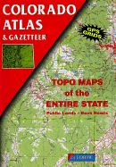
Add this copy of Colorado Atlas and Gazetteer to cart. $29.19, new condition, Sold by Wide World Maps & More rated 4.0 out of 5 stars, ships from Phoenix, AZ, UNITED STATES, published 1991 by Delorme Mapping Company.
Add this copy of Colorado Atlas and Gazetteer to cart. $79.92, new condition, Sold by GridFreed rated 4.0 out of 5 stars, ships from North Las Vegas, NV, UNITED STATES, published 1991 by Delorme.
This gazetteer includes everything from an index to populated places to lists of 14ers ? 56 peaks that are taller than 14,000 feet! There is a guide to dozens of mountain passes best travelled by four-wheel drive. It includes a publicly owned lands locator map. If fishing is your passion, you will love this gazetteer?s guide to Gold Medal Streams. I am seldom without my gazetteer. It is SO much better than a map and the DeLorme gazetteers are GPS compliant!