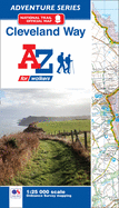
The A-Z Adventure Series of maps combines the best of OS and A-Z, creating the perfect companion for walkers, off-road cyclists, horse riders and anyone wishing to explore the great outdoors. The Cleveland Way is a 109 mile (175 km) National Trail from Helmsley in the North York Moors National Park, to Saltburn-by-the-Sea, where it joins and then follows the coast to finish in Filey. The trail combines beautiful heather moorland countryside offering panoramic views and a dramatic coastline with spectacular coastal ...
Read More
The A-Z Adventure Series of maps combines the best of OS and A-Z, creating the perfect companion for walkers, off-road cyclists, horse riders and anyone wishing to explore the great outdoors. The Cleveland Way is a 109 mile (175 km) National Trail from Helmsley in the North York Moors National Park, to Saltburn-by-the-Sea, where it joins and then follows the coast to finish in Filey. The trail combines beautiful heather moorland countryside offering panoramic views and a dramatic coastline with spectacular coastal scenery. There are numerous historical buildings, ancient features, interesting towns and fishing villages to encounter along the way. The route on the map is clearly highlighted in yellow. This official National Trail Map* of the Cleveland Way features 39 pages of continuous Ordnance Survey 1:25000 mapping providing complete coverage of the Cleveland Way. The atlas includes a route planner showing distances between places and the amenities available, featuring: *Information Centres *Hotels/B&Bs *Youth Hostels *Campsites (seasonal opening) *Public Houses *Shops *Restaurants *Cafes (seasonal opening) *Petrol Stations Also featured is advice on safety and security when walking and a selection of QR codes linked to useful websites, including temporary route updates from the National Trails, regional information, map reading advice and weather reports. Unlike the original OS sheets, this A-Z Adventure Atlas includes a comprehensive index to towns, villages, hamlets and locations, natural features, nature reserves, car parks and youth hostels, making it easy to find the required location quickly. Each index entry has a page reference and a six figure National Grid Reference. With a book size of 240mm x 134mm it is the same size as the standard OS folded map. Other National Trails available within the A-Z Adventure series include: Cotswold Way, England Coast Path (sections), Hadrian's Wall Path, Norfolk Coast Path & Peddars Way, North Downs Way, Pembrokeshire Coast Path, Offa's Dyke Path, Pennine Way, South Downs Way, SW Coast Path, Thames Path, The Ridgeway and Yorkshire Wolds Way. *A-Z is the official mapping partner of the National Trails.
Read Less
Add this copy of Cleveland Way National Trail Official Map: With to cart. $12.52, new condition, Sold by GreatBookPrices rated 4.0 out of 5 stars, ships from Columbia, MD, UNITED STATES, published 2017 by Geographers' A-Z Map Co Ltd.
Choose your shipping method in Checkout. Costs may vary based on destination.
Seller's Description:
New. Glued binding. -Z Adventure Series . In Stock. 100% Money Back Guarantee. Brand New, Perfect Condition, allow 4-14 business days for standard shipping. To Alaska, Hawaii, U.S. protectorate, P.O. box, and APO/FPO addresses allow 4-28 business days for Standard shipping. No expedited shipping. All orders placed with expedited shipping will be cancelled. Over 3, 000, 000 happy customers.
Add this copy of Cleveland Way National Trail Official Map to cart. $12.53, new condition, Sold by Paperbackshop rated 5.0 out of 5 stars, ships from Bensenville, IL, UNITED STATES, published 2017 by HarperCollins Publishers.
Add this copy of Cleveland Way National Trail Official Map: With to cart. $20.66, new condition, Sold by Booksplease rated 4.0 out of 5 stars, ships from Southport, MERSEYSIDE, UNITED KINGDOM, published 2017 by Geographers' A-Z Map Co Ltd.
Add this copy of Cleveland Way Adventure Atlas (Adventure Series) to cart. $21.36, new condition, Sold by Kennys.ie rated 4.0 out of 5 stars, ships from Galway, IRELAND, published 2017 by Geographers' A-Z Map Co Ltd.