This map is part of the Ordnance Survey's Explorer series designed to replace the old Pathfinder map series. At 1:25,000 scale this detailed map shows a host of attractions including gardens which are open to the public, nature reserves and country parks as well as all official footpaths, bridleways, roads and lanes. Other facilities covered include: camping and caravan sites, picnic areas and viewpoints, selected places of interest, rights of way information for England and Wales, National Trail and Recreational Path ...
Read More
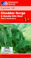
This map is part of the Ordnance Survey's Explorer series designed to replace the old Pathfinder map series. At 1:25,000 scale this detailed map shows a host of attractions including gardens which are open to the public, nature reserves and country parks as well as all official footpaths, bridleways, roads and lanes. Other facilities covered include: camping and caravan sites, picnic areas and viewpoints, selected places of interest, rights of way information for England and Wales, National Trail and Recreational Path routes, and selected tourist information. The main advantages of this map are the geographical design of the sheetlines to capture the best local coverage, and the coverage of a larger area for value for money. The series is aimed mainly at the experienced map user but can be used by tourists and locals alike.
Read Less
Add this copy of Cheddar Gorge and Mendip Hills West (Explorer Maps) to cart. $23.61, good condition, Sold by Goldstone Books rated 4.0 out of 5 stars, ships from Ammanford, CARMS, UNITED KINGDOM, published 1998 by Ordnance Survey.
Choose your shipping method in Checkout. Costs may vary based on destination.
Seller's Description:
Good. All orders are dispatched within 1 working day from our UK warehouse. Established in 2004, we are dedicated to recycling unwanted books on behalf of a number of UK charities who benefit from added revenue through the sale of their books plus huge savings in waste disposal. No quibble refund if not completely satisfied.