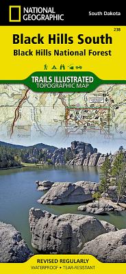
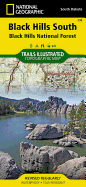
This Trails Illustrated topographic map for South Dakota's Black Hills, Wind Cave National Park, Mt Rushmore, and surrounding area, is the perfect map for exploring this magical wilderness. The map includes Wind Cave National Park, Custer State Park, Black Hills National Forest, Norbeck Wildlife Preserve, Sylvan Lake, Stockade Lake, Legion Lake, Center Lake, Elk Mountain, Bison Flats, Limestone Canyon, and much more. Includes UTM tick marks for use with your GPS unit.
Read More
This Trails Illustrated topographic map for South Dakota's Black Hills, Wind Cave National Park, Mt Rushmore, and surrounding area, is the perfect map for exploring this magical wilderness. The map includes Wind Cave National Park, Custer State Park, Black Hills National Forest, Norbeck Wildlife Preserve, Sylvan Lake, Stockade Lake, Legion Lake, Center Lake, Elk Mountain, Bison Flats, Limestone Canyon, and much more. Includes UTM tick marks for use with your GPS unit.
Read Less
Add this copy of National Geographic Trails Illustrated Map Black Hills to cart. $25.34, new condition, Sold by Revaluation Books rated 4.0 out of 5 stars, ships from Exeter, DEVON, UNITED KINGDOM, published 2009 by Natl Geographic Maps.
Add this copy of Black Hills National Forest, Southeast, Windcave to cart. $26.50, new condition, Sold by Blackwell's rated 3.0 out of 5 stars, ships from Gloucester, GLOUCESTERSHIRE, UNITED KINGDOM, published 2009 by National Geographic Maps Division.
Add this copy of Black Hills National Forest, Southeast, Windcave to cart. $26.60, new condition, Sold by Paperbackshop rated 4.0 out of 5 stars, ships from Bensenville, IL, UNITED STATES, published 2012 by National Geographic Maps.
Add this copy of Black Hills South Map [Black Hills National Forest] to cart. $36.69, good condition, Sold by Bonita rated 4.0 out of 5 stars, ships from Newport Coast, CA, UNITED STATES, published 2019 by National Geographic Maps.
Add this copy of Black Hills South [Black Hills National Forest] to cart. $65.46, new condition, Sold by Bonita rated 4.0 out of 5 stars, ships from Newport Coast, CA, UNITED STATES, published 2019 by National Geographic Maps.


![National Geographic Road Atlas 2024: Adventure Edition [United States, Canada, Mexico]](https://www3.alibris-static.com/images/elements/image_coming_soon.png)
![National Geographic Road Atlas 2024: Scenic Drives Edition [United States, Canada, Mexico]](https://www4.alibris-static.com/national-geographic-road-atlas-2024-scenic-drives-edition-united-states-canada-mexico/isbn/9781566957069.gif)