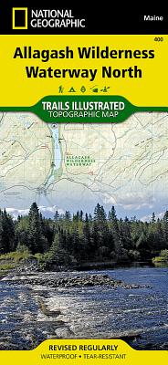
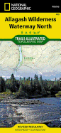
- Waterproof - Tear-Resistant - Topographic Map The Allagash Wilderness Waterway is a majestic 92-mile-long ribbon of rivers, lakes, ponds, and streams that winds its way through the heart of the North Maine Woods. National Geographic's Trails Illustrated map of Allagash Wilderness Waterway North is designed to meet the needs of outdoor enthusiasts by combining valuable information with unmatched detail of this popular recreation area. Created in partnership with local land management agencies, this expertly researched ...
Read More
- Waterproof - Tear-Resistant - Topographic Map The Allagash Wilderness Waterway is a majestic 92-mile-long ribbon of rivers, lakes, ponds, and streams that winds its way through the heart of the North Maine Woods. National Geographic's Trails Illustrated map of Allagash Wilderness Waterway North is designed to meet the needs of outdoor enthusiasts by combining valuable information with unmatched detail of this popular recreation area. Created in partnership with local land management agencies, this expertly researched map features key areas of interest including Fort Kent State, Saint John River, Saint Froid Lake, Round Pond, Allagash River, Umsaskis Lake, Fish River, Long Lake, Debouille Ecological Reserve, and the Musquacook lakes. Whether paddling the Northern Forest Canoe Trail, camping in the North Maine Woods, or driving the Maine Scenic Byway, this map performs as a highly functional travel tool that is as useful as it is remarkably crafted. The map base includes contour lines, shaded relief, and elevations for summits and many lakes. Recreation features are clearly marked, including picnic areas, trailheads, RV camping, primitive campsites, canoe carry downs, and boat launches. This map is loaded with valuable information such as watercraft regulations, rules for recreational use and access, river difficulty scale, checkpoints, visitor and ranger station locations, and more. Every Trails Illustrated map is printed on "Backcountry Tough" waterproof, tear-resistant paper. A full UTM grid is printed on the map to aid with GPS navigation. Other features found on this map include: Allagash River, Eagle Lake. Map Scale = 1:63,360 Sheet Size = 37.75" x 25.5" Folded Size = 4.25" x 9.25"
Read Less
Add this copy of Allagash Wilderness Waterway, North to cart. $11.76, new condition, Sold by Ambis Enterprises LLC rated 3.0 out of 5 stars, ships from Benton Harbor, MI, UNITED STATES, published 2011 by National Geographic Maps.
Choose your shipping method in Checkout. Costs may vary based on destination.
Seller's Description:
New. Brand New! Not Overstocks or Low Quality Book Club Editions! Direct From the Publisher! We're a small town bookstore that loves books and loves it's customers! Buy from US! Trade paperback (US). Glued binding. Ti - Other Rec. Areas.
Add this copy of National Geographic Trails Illustrated Map North to cart. $25.62, new condition, Sold by Revaluation Books rated 4.0 out of 5 stars, ships from Exeter, DEVON, UNITED KINGDOM, published 2010 by Natl Geographic Society Maps.
Add this copy of Allagash Wilderness Waterway, North Trails Illustrated to cart. $28.11, new condition, Sold by Paperbackshop rated 4.0 out of 5 stars, ships from Bensenville, IL, UNITED STATES, published 2012 by National Geographic Maps.
Add this copy of Allagash Wilderness Waterway North Map (National to cart. $32.88, good condition, Sold by Bonita rated 4.0 out of 5 stars, ships from Newport Coast, CA, UNITED STATES, published 2020 by Natl Geographic Society Maps.
Add this copy of Allagash Wilderness Waterway North Map (National to cart. $62.57, new condition, Sold by Bonita rated 4.0 out of 5 stars, ships from Newport Coast, CA, UNITED STATES, published 2020 by Natl Geographic Society Maps.


![National Geographic Road Atlas 2024: Adventure Edition [United States, Canada, Mexico]](https://www3.alibris-static.com/images/elements/image_coming_soon.png)