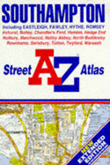
This street atlas, scale 4" to 1 mile (1:15,840), extends to Eastleigh, Totton, Netley Abbey, Hamble, Warsash, Botley, Hedge End, Bursledon, Salisbury, Rownhams. Alterations to this edition includes: 1C16-4C16 - Tollbar Way has been upgraded to part of the B3342; 5B16-6C16 - Upper Northam Road has been upgraded to part of the B3342; 1B30-5B30 - the remining part of Totton Western By-pass is shown as open.
Read More
This street atlas, scale 4" to 1 mile (1:15,840), extends to Eastleigh, Totton, Netley Abbey, Hamble, Warsash, Botley, Hedge End, Bursledon, Salisbury, Rownhams. Alterations to this edition includes: 1C16-4C16 - Tollbar Way has been upgraded to part of the B3342; 5B16-6C16 - Upper Northam Road has been upgraded to part of the B3342; 1B30-5B30 - the remining part of Totton Western By-pass is shown as open.
Read Less
Add this copy of A. to Z. Street Atlas of Southampton (Road Atlas) to cart. $15.09, good condition, Sold by Goldstone Books rated 4.0 out of 5 stars, ships from Ammanford, CARMS, UNITED KINGDOM, published 1999 by Geographers' A-Z Map Co Ltd.
Choose your shipping method in Checkout. Costs may vary based on destination.
Seller's Description:
Good. All orders are dispatched within 1 working day from our UK warehouse. Established in 2004, we are dedicated to recycling unwanted books on behalf of a number of UK charities who benefit from added revenue through the sale of their books plus huge savings in waste disposal. No quibble refund if not completely satisfied.
Add this copy of Southampton Including Eastleigh, Fawley, Hythe, Romsey: to cart. $15.10, good condition, Sold by Goldstone Books rated 4.0 out of 5 stars, ships from Ammanford, CARMS, UNITED KINGDOM, published 1995 by Geographer's A-Z Map Comp.
Choose your shipping method in Checkout. Costs may vary based on destination.
Seller's Description:
Good. All orders are dispatched within 1 working day from our UK warehouse. Established in 2004, we are dedicated to recycling unwanted books on behalf of a number of UK charities who benefit from added revenue through the sale of their books plus huge savings in waste disposal. No quibble refund if not completely satisfied.
Add this copy of Southampton Including Eastleigh, Fawley, Hythe, Romsey: to cart. $15.99, good condition, Sold by Brit Books rated 4.0 out of 5 stars, ships from Milton Keynes, BUCKINGHAMSHIRE, UNITED KINGDOM, published 1995 by Geographer's A-Z Map Comp.
Choose your shipping method in Checkout. Costs may vary based on destination.
Seller's Description:
Good. Simply Brit welcome to our online used book store, where affordability meets great quality. Dive into a world of captivating reads without breaking the bank. We take pride in offering a wide selection of used books, from classics to hidden gems, ensuring there's something for every literary palate. All orders are shipped within 24 hours and our lightning fast-delivery within 48 hours coupled with our prompt customer service ensures a smooth journey from ordering to delivery. Discover the joy of reading with us, your trusted source for affordable books that do not compromise on quality.