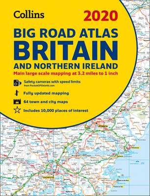
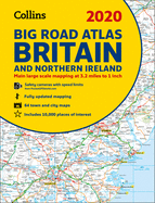
The ultimate 3.2 miles to 1 inch scale A3 spiral bound road atlas of Britain and Northern Ireland for 2020, featuring Collins' popular and well-established road mapping. Designed for exceptional clarity and ease of use. The atlas includes a wide range of urban area maps at even larger scale and 64 detailed town centre street plans. The mapping shows speed limits at speed camera locations. This fully updated road atlas covers the whole of Britain and Northern Ireland with each scale of mapping colour ...
Read More
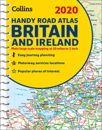
The ultimate 3.2 miles to 1 inch scale A3 spiral bound road atlas of Britain and Northern Ireland for 2020, featuring Collins' popular and well-established road mapping. Designed for exceptional clarity and ease of use. The atlas includes a wide range of urban area maps at even larger scale and 64 detailed town centre street plans. The mapping shows speed limits at speed camera locations. This fully updated road atlas covers the whole of Britain and Northern Ireland with each scale of mapping colour-coded for ease of use. The smallest scale maps are great for long distance route planning and the street plans help you locate your final destination. * Easy to use, clear road maps at a scale of 3.2 miles to 1 inch of England, Wales, Southern Scotland and Northern Ireland. Northern Scotland is shown at 5 miles to 1 inch * Route planning section including maps at a scale of 15.8 miles to 1 inch (1:1,000,000) for long distance route planning, motorway services information and a handy distance calculator * 22 urban area approach maps at 1 mile to 1 inch which clearly show the best routes through and into the busiest built-up areas * 64 street maps focused on town centres showing places of interest, car park locations and one-way streets * Fully updated fixed speed camera sites with average speed camera locations clearly highlighted. All speed cameras show the speed limit * Information about restricted motorway junctions * Park & Ride locations shown, ideal when visiting towns and cities * Over 30 categories of places of interest including castles, theme parks, sports venues, universities, mountain bike trails and surfing beaches * Full postcodes for the top 1000 places of interest - ideal for use alongside satnav systems
Read Less
Add this copy of 2020 Collins Big Road Atlas Britain and Northern to cart. $10.97, like new condition, Sold by 8trax Media rated 5.0 out of 5 stars, ships from Mansfield, MA, UNITED STATES, published 2019 by Collins.
Add this copy of 2020 Collins Big Road Atlas Britain and Northern to cart. $10.97, very good condition, Sold by 8trax Media rated 5.0 out of 5 stars, ships from Mansfield, MA, UNITED STATES, published 2019 by Collins.
Add this copy of 2020 Collins Big Road Atlas Britain and Northern to cart. $12.00, new condition, Sold by Marissa's Books and Gifts rated 5.0 out of 5 stars, ships from Salt Lake City, UT, UNITED STATES, published 2019 by Collins.
Add this copy of 2020 Collins Big Road Atlas Britain and Northern to cart. $12.99, new condition, Sold by Redux Books rated 5.0 out of 5 stars, ships from Wyoming, MI, UNITED STATES, published 2019 by Collins.
Add this copy of 2020 Collins Big Road Atlas Britain and Northern to cart. $15.83, very good condition, Sold by Ebooksweb rated 3.0 out of 5 stars, ships from Bensalem, PA, UNITED STATES, published 2019 by Collins.
Add this copy of 2020 Collins Big Road Atlas Britain and Northern to cart. $16.25, like new condition, Sold by Ebooksweb rated 3.0 out of 5 stars, ships from Bensalem, PA, UNITED STATES, published 2019 by Collins.
Add this copy of 2020 Collins Big Road Atlas Britain and Northern to cart. $16.88, new condition, Sold by Ebooksweb rated 3.0 out of 5 stars, ships from Bensalem, PA, UNITED STATES, published 2019 by Collins.
Add this copy of 2020 Collins Big Road Atlas Britain and Northern to cart. $16.95, new condition, Sold by Warriors SG rated 5.0 out of 5 stars, ships from Somerset, NJ, UNITED STATES, published 2019 by Collins.
Add this copy of 2020 Collins Big Road Atlas Britain and Northern to cart. $17.11, good condition, Sold by Goodwill of Colorado rated 4.0 out of 5 stars, ships from COLORADO SPRINGS, CO, UNITED STATES, published 2019 by Collins.
Choose your shipping method in Checkout. Costs may vary based on destination.
Seller's Description:
This item is in overall good condition. Covers and dust jackets are intact but may have minor wear including slight curls or bends to corners as well as cosmetic blemishes including stickers. Pages are intact but may have minor highlighting/ writing. Binding is intact; however, spine may have slight wear overall. Digital codes may not be included and have not been tested to be redeemable and/or active. Minor shelf wear overall. Please note that all items are donated goods and are in used condition. Orders shipped Monday through Friday! Your purchase helps put people to work and learn life skills to reach their full potential. Orders shipped Monday through Friday. Your purchase helps put people to work and learn life skills to reach their full potential. Thank you!
Add this copy of 2020 Collins Big Road Atlas Britain and Northern to cart. $47.41, new condition, Sold by Revaluation Books rated 4.0 out of 5 stars, ships from Exeter, DEVON, UNITED KINGDOM, published 2019 by Collins.