During 2007, a sampling campaign was conducted in grassland and shrubland areas in the states of Jalisco, Estado de M???xico, Zacatecas, Coahuila, Durango and Quer???taro, using multispectral radiometers in field conditions, in order to obtain information to analyze the relationship between vegetation reflectance obtained by using optical sensors with aerial cover and biomass production. Additionally, digital photographs were taken to estimate aerial cover using supervised classification methods. Aerial biomass sampling was ...
Read More
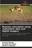
During 2007, a sampling campaign was conducted in grassland and shrubland areas in the states of Jalisco, Estado de M???xico, Zacatecas, Coahuila, Durango and Quer???taro, using multispectral radiometers in field conditions, in order to obtain information to analyze the relationship between vegetation reflectance obtained by using optical sensors with aerial cover and biomass production. Additionally, digital photographs were taken to estimate aerial cover using supervised classification methods. Aerial biomass sampling was carried out in 15% of the measurement points. With the sampling scheme used, the relationships between different vegetation indices (NDVIcp, IVCP and ) with biomass and aerial cover were analyzed, establishing a relationship between these biophysical variables. The estimation of biomass and vegetation cover in a faster way, allows estimating the condition, trend or production of natural vegetation in grasslands and shrublands, making it possible to make management decisions in a more efficient and expeditious way.
Read Less
Add this copy of Biomass calculation using radiometric data and digital to cart. $50.68, new condition, Sold by Ingram Customer Returns Center rated 5.0 out of 5 stars, ships from NV, USA, published 2024 by Our Knowledge Publishing.